
ODMAP
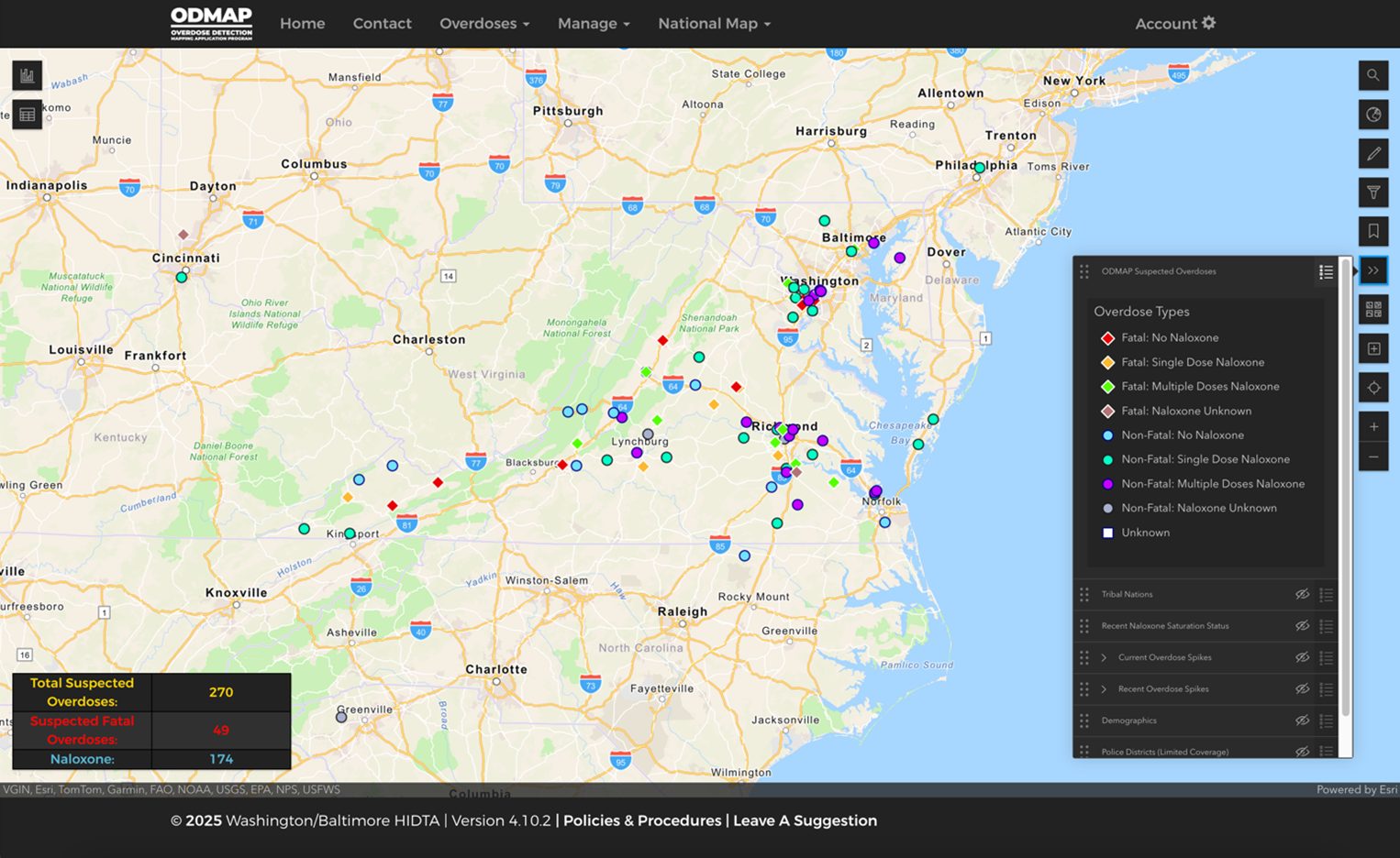
The Overdose Detection Mapping Application Program (ODMAP) is a free, web-based tool that provides near real-time suspected overdose surveillance data across jurisdictions to support public safety and public health efforts in mobilizing an immediate response to a sudden increase or spike in overdose events. For over eight years, ODMAP has been available to government (state, local, federal, or tribal) agencies serving the interests of public safety and health. Each agency wishing to participate signs a participation agreement designed to protect the data within the system. Once signed up, they can begin uploading data and have access to the National Map feature, which allows users to view nationwide data and built-in analytical tools (i.e., filters, pre-built charts, and the ability to add additional data layers).
Approved users will also have access to several built-in features that aim to support agencies efforts, including, but not limited to:
- Spike Alerts – Spike alerts send email notifications to a subscriber list when a designated area meets or exceeds a certain number of overdose events within a rolling 24-hour period. Spike alerts are available at the county level or using the custom geography feature. Users can also see where spike alerts are in effect across the country using the current and recent (within the last seven days) layers.
- Spike Response Framework – A tool for agencies to use when setting up their spike response, including information on how to integrate ODMAP into their response efforts.
- Custom Shapes and Bookmarks – These features allow users to create their own custom geographic boundaries and save them for future use or for triggering spike alerts.
- Add Your Own Data – Users can layer additional data sets onto ODMAP, including their own data, to better understand spatial relationships or add additional data using Esri’s Living Atlas.
- Naloxone Saturation Layer (NSL) – Partners across the country share data on the number of publicly available naloxone kits, which are visualized based on the ODMAP naloxone saturation data definition.
- Tribal Nations Layer – This new feature allows users to filter data by reservations, similar to how you can filter by states or counties. A built-in layer displays the various reservation boundaries on the map.
Disclaimer – The data in the map above does not represent any actual overdose events
Currently, over 5,300 agencies in all 50 states, the District of Columbia, and Puerto Rico are utilizing the tool. As of April 2025, nearly 3 million overdose events have been entered. Approximately 35 states and the District of Columbia have a statewide ODMAP implementation strategy, including 25 states with a statewide Application Programming Interface (API) to push data directly from their state systems to ODMAP.
- ODMAP Overview
- ODMAP Statewide Implementation Strategies
- ODMAP API Guidance Document – for agencies interested in setting up an API with ODMAP
The ODMAP team continues to work toward improving the platform and collaborating with stakeholders to learn more about how ODMAP is being used in the field. ODMAP has developed a series of spotlight videos and one-pagers on programs utilizing ODMAP in the field across the country. The goal is to further support and facilitate collaboration, communication, and coordination within the ODMAP community.
For more information about ODMAP, please see:
Or contact use at odmap@wb.hidta.org